Welcome to the trail!
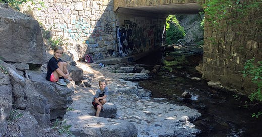
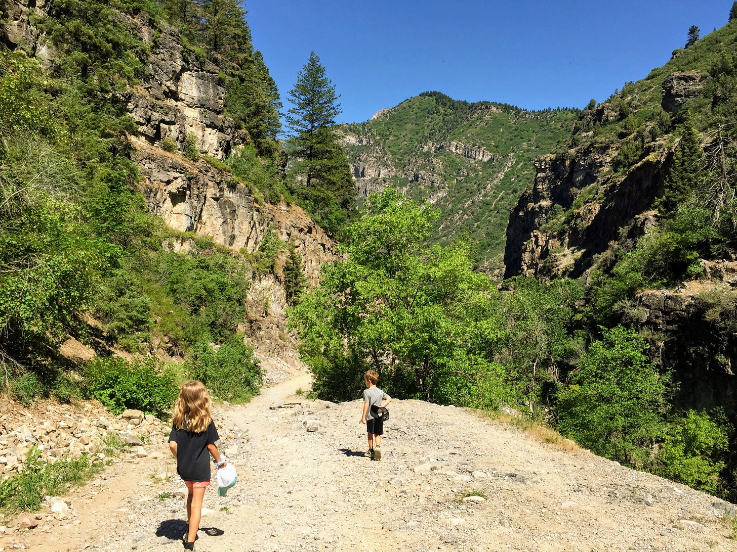
This week we’re hiking the Wheeler Creek Trail in Wheeler Canyon, near the Pineview Dam in at the mouth of Ogden Canyon. A gradual climb up a wide, rocky path with steep canyon walls towering on either side leads to three options for water access destinations: just past the “graffiti bridge” pictured above is a “campsite beach” area with stream access, and not much further past that is a wooden bridge that would make a good turn around point for those wanting a 2+ mile round trip hike. It’s a choose your own adventure kind of hike! Let’s go!
How to get there
From anywhere in the Ogden Valley, drive toward Ogden Canyon, heading west (toward Ogden). Just a quarter mile past the dam on the south (left) side of the road, you’ll see a parking area, often packed with cars. This is the overflow parking for the trailhead, but even if it’s full near the highway, it’s worth driving the tenth of a mile down the dirt road to check if you can park right next to the trailhead. About ten cars can fit parallel parked on either side of the entrance. Pay attention to the private property and no parking signs on the drive down and beyond the lot. There are no restroom facilities at this trailhead.
Trail at a glance
Total distance: (choose your own destination!)
0.75 miles to “graffiti bridge” (1.5 miles round trip out and back)
0.8 miles to “campsite beach” (1.6 miles round trip out and back)
1.15 miles to “wooden bridge” (2.3 miles round trip out and back)
Elevation gain:
“graffiti bridge”: ~180 feet
“campsite beach”: ~180 feet
“wooden bridge”: ~240 feet
Destination: (none of these are official names, of course!)
“graffiti bridge” is a bit of a scramble (but definitely doable, even with tiny tykes, especially if you have a friend to help pass the kids) down below the trail where Wheeler Creek crosses under the path - wide, flat rocks next to the creek, access under the trail, and a cool, shady spot to rest and splash make this a super fun spot to visit
“campsite beach” is a gradual path off the main trail that takes you right to the creek, with a couple of primitive fire rings nestled under the trees along the way - this would be the easiest way to access water on this hike
“wooden bridge” is at the mouth of Icebox Canyon (you may recognize it from hiking the Icebox Canyon Loop) - there’s not a great place to play in the water here, unless you want to do so from the bridge (a la Poohsticks), but it is a good turn around point to boost your total mileage to just over 2 miles round trip
Tyke perks: partly shady (best in morning or evening), wide path, mini waterfalls/rapids to see and hear down below the trail, playing in the creek, graffiti, bridges
Notable flora: yellow sweet clover, western salsify, flax, alfalfa, penstemon, wild rose, milkweed, maple, mountain ash, fir
Fascinating fauna: songbirds, butterflies
Watch out for: sun (if you’re there midday, it can get pretty warm), bikes (lots of bikers love this trail, but it is wide, so not as stressful as some trails), horses (probably only closer to Icebox Canyon), steep drop offs down to the creek (you can avoid these by walking on the opposite side of the plenty-wide trail), rocks (they can get a bit slippery on the downhill return)
While you’re hiking
This trail is pretty straightforward (it’s hard to get lost when you’re surrounded by towering walls on either side). Just start walking on the trail past the gate at the end of the parking area. It will gradually climb it’s way up through the canyon.
A quarter mile in you’ll see a trail leading down to the left to a new-looking building with a solar panel set-up. I don’t know what this is, but just stay on the main trail heading up.
At mile 0.3 you’ll notice the trail gets a little steeper and rockier, but it’s short lived and lessens again in just a couple hundred feet.
See if your kids notice the “seat rock” on the side of the trail at the half mile mark (I’ll admit mine said it looked like a toilet!).
When you reach mile 0.75, you’ll see a smaller trail heading to the right as the creek passes under the main trail. Follow this down (you’ll have to scramble down a couple of rocky steps) to get to our first destination: “graffiti bridge”.
If you want to go to “campsite beach” instead, just stay on the main trail as it passes over the creek and walk about 250 feet further till you see another small trail going off to the right. This is a gradual descent to the water, with lots of shoreline and shade to rest in.
Our final destination is about a quarter mile further. At mile 1.1 you’ll see a sign on the right pointing back toward the Wheeler Creek Trailhead or ahead to the Art Nord Trailhead. Someone has handwritten in a third direction toward Icebox Canyon, which takes you 250 feet down a hill to the wooden bridge you can see below.
From whichever spot you make it to, just turn around and return the way you came.
Happy hikers
Hope you’re hiking and hope you’re happy! You know what to do with those buttons below! Happy trails!


