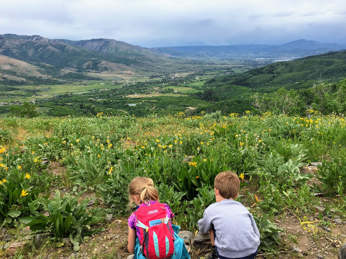
Welcome to the trail!
The Mule Ear Trail in North Fork Park is a gem, especially in June when its namesake flowers are in blossom. There probably won’t be as many perky yellow blooms along the trail if you hike it now that it’s warmer and drier, but the views will still be lovely! Or, you can save it on your hiking bucket list till next June! (What, doesn’t everyone have a hiking bucket list?)
I’ve got three “difficulty level” options for this trail today in hopes that you find one that fits you and your hikin’ tykes perfectly.
How to get there
From Valley Market in Eden, drive northwest on Highway 162 for about 2.5 miles where you merge onto 3500 E and continue about a half mile to the three-way stop near Liberty Park. Turn left on 4100 N then right on 3300 E and continue driving north for about 1.5 miles until you take a slight left onto North Fork Road. You’ll stay on North Fork Road for 2.7 miles, driving past both the South and Middle Gates, and turning left on North Gate Road (the sign calls it Cutler Flats Gate). In about a half mile you’ll get to a T intersection; turn left and follow the road around for another 0.4 miles till you see a large trailhead sign on your right. Just past the sign on your left is an entrance to a large U-shaped parking area. Park here. A couple of covered picnic tables are situated around the edge of the lot. No restrooms are available here.
The trail starts across the street near the big trailhead sign mentioned above. There is a small trail leading from the parking area to the trailhead, or you can just walk out the parking lot and across the road.
Trail at a glance
Total distance: (remember, there are three options for hiking this trail that I’ll describe below)
Mule Ear Connector Out and Back: 0.65 miles one way (1.3 miles round trip)
Mule Ear Overlook Out and Back: 1.4 miles one way (2.8 miles round trip)
Mule Ear Overlook Loop: 3.3 miles round trip
Elevation gain:
Mule Ear Connector Out and Back: ~190 feet
Mule Ear Overlook Out and Back: ~690 feet
Mule Ear Overlook Loop: ~800 feet
Destination:
Mule Ear Connector Out and Back: shady walk through trees with some views of valley and Pineview, turnaround point is a dirt road/trail crossing
Mule Ear Overlook Out and Back: overlook with views of valley and Pineview, additional overlook of North Fork Park waterfall
Mule Ear Overlook Loop: overlook with views of valley and Pineview, additional overlook of North Fork Park waterfall
Tyke perks: shade, bridge, views, benches, rocks (to build cairns), caterpillar nests
Notable flora: (note: we hiked this in mid June, so the blooming flora may be slightly different a month later) salsify, geranium, mules ear, dyer’s woad (they’ll probably have black seeds by now), houndstongue, wild alium, thimbleberries, forget-me-not, blue flax, scarlet gilia, wild rose, arrowleaf balsamroot, lupine, fir, aspen, chokecherry, oak, sagebrush
Fascinating fauna: turkeys, songbirds, lizards, dragonflies, butterflies, deer
Watch out for: sun, horses, bikers, moose, stinging nettle, mountain lions (they’re rare, but they do live in the area)
While you’re hiking
Option 1: Mule Ear Connector Out and Back
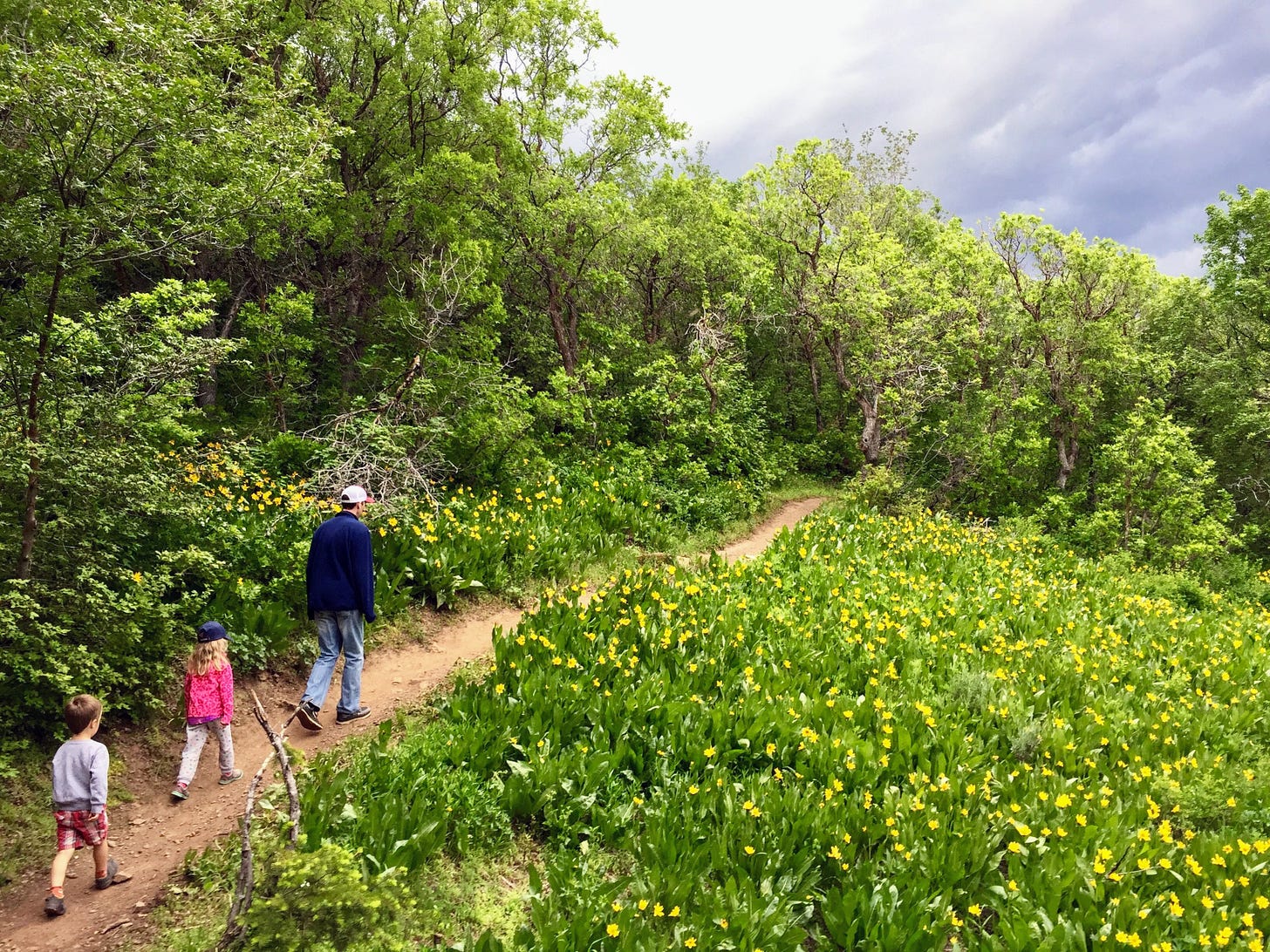
This one is probably your best bet for the younger/newer to hiking set. It’s the shortest and flattest option, but it offers plenty of beauty (and a small bridge).
From your parking spot, find the small trail on the north end of the lot that leads west (toward the road). Follow it across the road to the trailhead sign. A few feet beyond the big sign is a crossroads of trails. Follow the sign pointing left (south) for the Connector trail.
In about a tenth of a mile you’ll cross a small bridge. Shortly after that the trees open up enough to see the parking lot below to your left. (I spy our car!) At roughly the 0.2 mile mark you’ll be able to catch a first glimpse of the Ogden Valley and Pineview Reservoir.
Continue on this trail through the trees and flowers till you come to a wide gravel path/old road that crosses your trail at about mile 0.65. This is where we turn around and head back to the car. A short and sweet little jaunt through the woods.
Option 2: Mule Ear Overlook Out and Back

Full disclosure: I haven’t hiked this exact route as described (I’ve only come down this way while doing the loop from option 3), but it does cut off a little mileage and elevation gain and gets you to the same overlooks of the valley and the waterfall as the loop, so I think it’s a decent option for an out and back for hikers who are looking for a little more adventure.
From your parking spot, find the small trail on the north end of the lot that leads west (toward the road). Follow it across the road to the trailhead sign. A few feet beyond the big sign is a crossroads of trails. Continue straight on the Mule Ear Trail.
This trail takes you gradually upward through aspens and wildflowers. Keep your eyes peeled for the gnarly caterpillar nests that completely cover some of the branches along the trail. By roughly mile 0.6, the switchbacks are pretty much behind you. You’ll enter a mostly straight stretch for another 0.3 miles. Then you’ll make a big left curve followed by two last switchbacks just past the mile mark.
Once you’ve leveled out at the top of the climb, continue for about a hundred feet and watch for a trail heading slightly right; take it. This is the overlook trail. In a couple hundred feet you’ll see spectacular views of the valley and reservoir spread out in front of you to the south. There are two benches along this stretch that make for a perfect resting/dining place to soak in the view.
After you’ve caught your breath, continue on the overlook trail another 0.2-ish miles. If the waterfall is still flowing high, you’ll probably be able to hear it before you see it. (Note: later in the summer this waterfall can be nearly dry, so earlier is definitely better for prime waterfall viewing.) There is a bench about a tenth of a mile past the valley overlook that offers your first good glimpse of the waterfall across the canyon. You’ll have ample others as you continue on the last 0.1 miles to the benches at the dead end overlook. (There are also lots of rocks along this stretch that some kids can’t resist stacking into cairns along the side of the trail.)
It’s fun to look down at the bottom portion of the waterfall (and maybe see some folks at the base) and realize how much more of it there actually is that isn’t visible from so low! It’s quite impressively tall!
When you’ve had your fill of the scenery, just follow your steps back down to the parking area.
Option 3: Mule Ear Overlook Loop
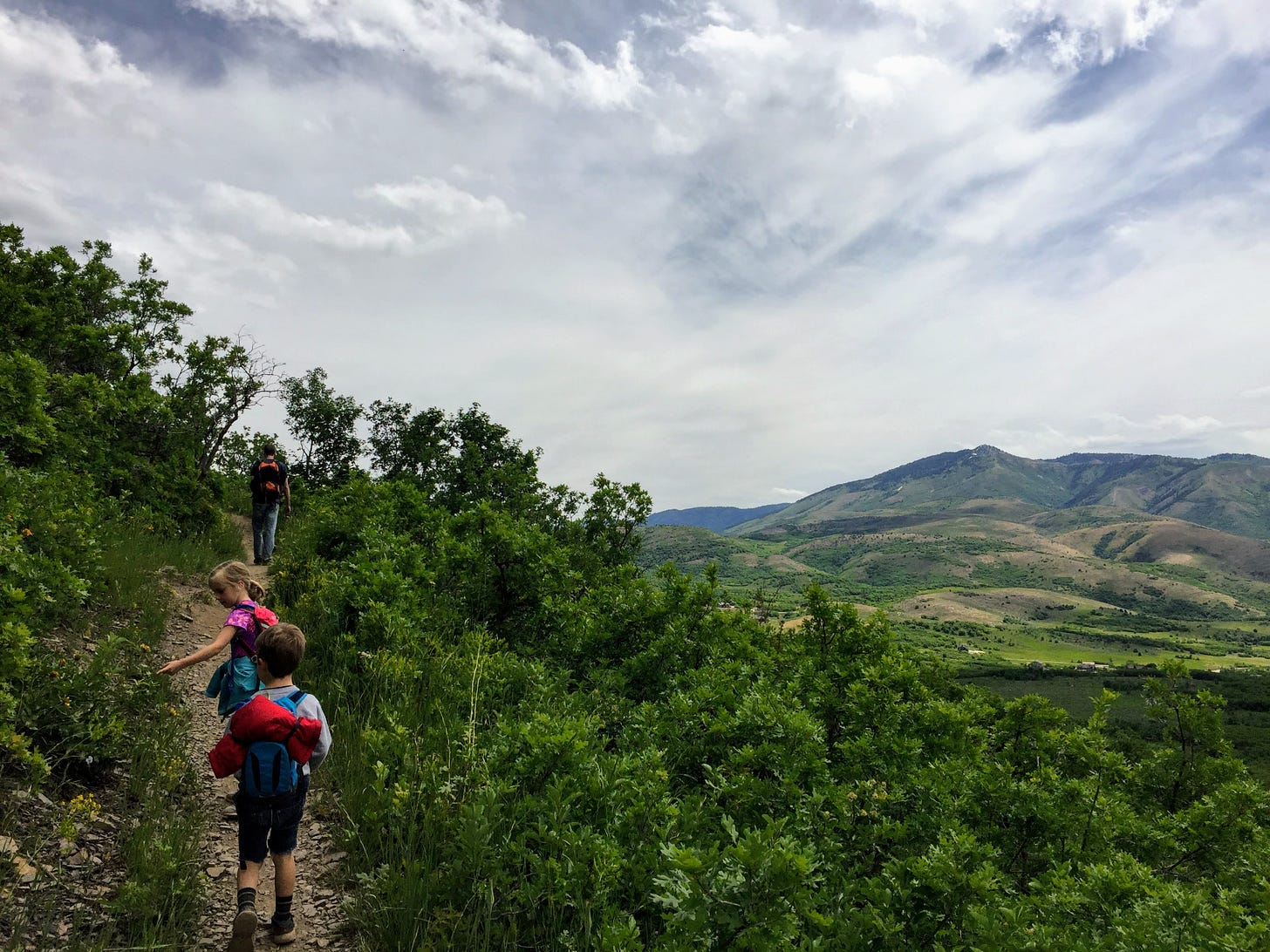
This one is the longest route of the three, and involves the most climbing, but being a loop you’ll always be seeing something new. Our 7 and 4 year hikers handled it amazingly well, so it’s definitely doable by the tykes, especially if they’ve had some practice.
From your parking spot, find the small trail on the north end of the lot that leads west (toward the road). Follow it across the road to the trailhead sign. A few feet beyond the big sign is a crossroads of trails. Follow the sign pointing left (south) for the Connector trail.
In about a tenth of a mile you’ll cross a small bridge. Shortly after that the trees open up enough to see the parking lot below to your left. (I spy our car!) At roughly the 0.2 mile mark you’ll be able to catch a first glimpse of the Ogden Valley and Pineview Reservoir.
Continue on this trail through the trees and flowers till you come to a wide gravel path/old road that crosses your trail at about mile 0.65. Turn right and follow the road to the west. You’re out of the trees for a while, so be prepared for some sun along here. Continue straight each time you come to a fork or a crossroads. In a tenth of a mile you’ll be back on a dirt trail and soon you’ll be turning toward the north and zigzagging up through the shade.
At the mile mark you’ll see a bench at a switchback with a view of the mountains through an opening in the trees. About 0.2 miles further you’ll pop out of the trees again with lovely valley views. By the time you hit the 1.8 mile point, you should be able to spy your car again in the parking lot way down below. Just before you hit two miles you’ll see a fork off to your left; take it. This is the overlook trail.
In a couple hundred feet you’ll see spectacular views of the valley and reservoir spread out in front of you to the south. There are two benches along this stretch that make for a perfect resting/dining place to soak in the view.
After you’ve caught your breath, continue on the overlook trail another 0.2-ish miles. If the waterfall is still flowing high, you’ll probably be able to hear it before you see it. (Note: later in the summer this waterfall can be nearly dry, so earlier is definitely better for prime waterfall viewing.) There is a bench about a tenth of a mile past the valley overlook that offers your first good glimpse of the waterfall across the canyon. You’ll have ample others as you continue on the last 0.1 miles to the benches at the dead end overlook. (There are also lots of rocks along this stretch that some kids can’t resist stacking into cairns along the side of the trail.)
It’s fun to look down at the bottom portion of the waterfall (and maybe see some folks at the base) and realize how much more of it there actually is that isn’t visible from so low! It’s quite impressively tall!
After you’ve had your fill of the vistas, turn around on the overlook trail and head back to the fork. This time stay straight/slight left to get back on the Mule Ear Trail and close out the loop. Follow the trail as it winds down through the lush trees and undergrowth. (This side of the mountain is surprisingly green for Utah hiking.) Keep your eyes peeled for the gnarly caterpillar nests that completely cover some of the branches along the trail. In about 1.2 easy downhill miles you’ll be back at the start!
Happy hikers

Have you tried any of these Tyke Hikes yet? Do you know a trail you think should be featured that I haven’t written about? Are your kiddos (or grandparents) catching the hiking bug? Let me know in the comments or hit reply to this email. (If you send me a photo, I’ll feature it here next time!) I’d love to hear what you think!


